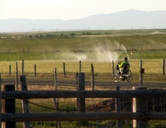
ROUTE: Burley to Blackfoot, ID
DISTANCE: 112 miles
WINDS: Kicking tailwind
WEATHER: Sunny, windy, and warm
TERRAIN: Mildly rolling
TOTAL CLIMBING: 2,050, nuthin much
RIDE OVERVIEW: Blackfoot, our destination today, is the largest potato producing community in the world, providing a third of the nation's potatoes. On the way into town we saw numerous potato fields and potato barns--barns buried to their sod roofs that work as cold cellars. The town name came from a bad translation of "Siksika" which means "Black moccasin" a term probably derived from the discoloration of moccasins with ashes. It was used as both the name of a single tribe (the Blackfoot), and for the confederacy they belonged. They called themselves Ni-kso-ki-wa.
The first 50 miles of our route were in a very desolate part of Idaho. The road we were on was rough chip and seal and in places where we had a vista, it seemed as though a child had taken a charcoal crayon and drawn a narrow line through dusty green. We were away from the fertile fields and mostly in sage grazing land, which was all open range where we had to deal with several cattle guards--the rails they put across the road to keep the cattle within a section of range. We had cattle crossing our route in several places today. Even if we didn't see the cattle on the road, we could tell they had been there by what they left behind. If we didn't detour around these droppings, our water bottles got a coating that created a unique flavor to enhance our Gatorade.
The second half of today's route was more populated and took us into some small towns . . . really small, but at least some civilization. There wasn't much climbing except for a few hills around the 45 mile point. Until then and after that, it was relatively flat but even with the tailwind the rough road surface in spots made it a little tougher than it should have been. The last 50 miles were on a road that could best be described as mind numbing. It just went on and on and on with not much to see as far as variety, but it had a shoulder and, thankfully, we had our tailwind. We also got to ride on I-86 for about 8 miles near the middle of the day. It was the best shoulder I've ever ridden on . . . smooth concrete without a rumble strip, and it was the cleanest I'd ever seen too. Several of the riders were tempted to take it directly to the hotel, but common sense won out (or maybe it was their fear of Mike's ire). It is illegal to ride the Interstate when there is an alternate route.
One interesting landmark we came across today was Register Rock at about the 42-mile point on our route. It's a big rock on which early pioneers carved their names to record their passing along the Snake River in the mid 1860s. One individual on his way to Portland, Oregon, scratched an Indian head on the stone in 1866 when he was 7 years old. As an adult, he became a sculptor and returned to the rock to check on his work and to sign it again in 1906. It really was an interesting landmark, and I tried to imagine what it was like in 1865 when settlers braved the elements, but found time to record their presence for all time. It was probably an easy place to find as all they had to do was follow I-86 to exit 28 and they were right there.
Well, I managed to ride all 112 miles today without any body parts falling off or giving me more than normal trouble. This because the wind was strong out of the northwest and we were headed southeast! What a kick to be sailing along in the twenties with minimal effort. Must be what the young guys feel like all the time. At times when we'd turn right or left we'd be blasted with a strong crosswind, and when we were approaching SS#2 we had to pedal about a mile directly into the north wind, but this only made us more thankful for our tailwind.
HEARD ON THE ROAD TODAY:
- "Cowabunga! Did you see that steer skull right by the road? Wonder if Barb would carry it in Box? Those things go for $50 to $200 on eBay?"
- "Boy, I thought I was going to get "shaken bicyclist syndrome" after riding on that rough road."
- "Did you look at the weather and wind direction this morning?"
"No I never look at it. We ride no matter what, and I like surprises."
PHOTOS OF THE DAY:
 |
| Dave attached a sprinkler head to his Camelbakto help out the farmers along the route. |
 |
| This is the last time Lisa is letting Jim navigate. Where's the road? |
 |
| Pete poses for the new ABB Chippendale calendar, soon to be released. We need 11 more models, so see me (and only me) if you're interested. |
 |
| Cliff wasn't taking any chances today as we rode by the reservoir. He inflated his jacket and wore a PFD, in addition to practicing raising his hand to call for help |
 |
| Staff gremlins preparing the ubiquitous Gatorade packets. |


No comments:
Post a Comment